CrestGeo brings extensive expertise in photogrammetry and geospatial mapping, delivering high-quality projects for clients worldwide. Our expertise covers everything from localized mapping projects to extensive government and infrastructure mapping programs. we provide accurate, reliable, and cost-effective geospatial solutions tailored to every project.
Aerial Triangulation & Photogrammetric Control
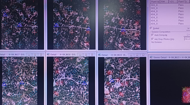
Aerial Triangulation (AT) is a critical first step in ensuring the positional accuracy of any
mapping project. CrestGeo performs AT using both frame-based aerial imagery and digital
camera data, including imagery captured by drones. Our team supports a wide range of camera
formats and offers both manual and automated tie-point collection, tailored to the specific
requirements of each project. Over the years, we have successfully completed Aerial
Triangulation projects of all sizes — from single-model assignments to large-scale mapping
programs — consistently delivering accurate, reliable results our clients depend on.
DIGITAL TERRAIN AND SURFACE MODELS
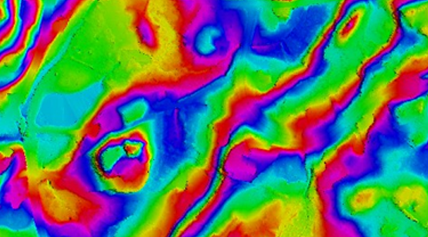
CrestGeo generates high-quality Digital Terrain Models (DTM), Digital Elevation Models
(DEM), and Triangulated Irregular Networks (TIN) using accurately captured breaklines and
mass points. Our experienced team delivers reliable surface models tailored to client
requirements and applicable project standards, including USGS and ASPRS specifications where
required.
TERRAIN & ELEVATION MODELING
CrestGeo is able to delineate highly accurate topographical details of a given area
and generate the best possible contours and elevation models through the careful
and meticulous collection of breaklines and mass points. We have experience
generating contours at all intervals, ranging from 0.5 feet to 5 feet. We also bring
strong expertise in hybrid mapping, where LiDAR-generated DEMs are used to
produce accurate contour datasets.
PLANIMETRIC FEATURE EXTRACTION
CrestGeo captures visible planimetric features with high precision using stereo photogrammetry,
including buildings, transportation networks, utilities, hydrographic features, and vegetation. We
have extensive experience delivering planimetric mapping projects while meeting engineering-
grade and client-specific mapping standards.
3D BUILDING & ROOF MODELING
CrestGeo provides detailed 3D building and roof feature extraction using
photogrammetric mapping techniques. Building footprints, roof edges, ridgelines, and
structural roof features are captured to create accurate 3D vector models for urban
mapping, planning, engineering, and GIS applications.
UTILITY AND INFRASTRUCTURE MAPPING
CrestGeo provides accurate utility and infrastructure mapping for municipal, county,
transportation, and infrastructure projects according to client specifications. Our capabilities
include mapping road-corridor features such as power poles, light poles, communication towers,
water meters, fire hydrants, manholes, catch basins, valves, cattle guards, signposts, traffic
signals, streetlights, road markings, and pedestrian crossings. For transmission-corridor projects,
we also capture features including pylons, pylon arms, guy wires, and distribution lines
according to project requirements.
IMPERVIOUS-SURFACE MAPPING
CrestGeo delivers 2D and 3D pervious and impervious feature mapping for county-wide and
regional projects. We accurately identify, classify, and map surface features across diverse
landscapes, from rural environments to densely populated urban areas, while meeting client-
specific standards and project requirements.
TOPOGRAPHIC AND ENGINEERING MAPPING
CrestGeo delivers engineering-grade mapping solutions for road corridor and hydrography
projects where precision is critical. Our team accurately captures planimetric features and
develops high-quality topographic models that meet stringent engineering and client-specific
accuracy requirements.
VOLUMETRIC AND CHANGE ANALYSIS
CrestGeo has extensive experience delivering volumetric mapping solutions for mining, landfill,
and earthwork projects. We produce accurate topographic maps to measure material excavation
and stockpile volumes, while our change detection analysis compares datasets from different
time periods to generate reliable volumetric reports for monitoring and decision-making.